
Terrestrial Equipment
The terrestrial equipment for practical field work, which is maintained by MTU, is used in the introductory course for all geoscience students ("Methods of Geophysical Exploration") and later in the master programm "Applied Geosciences" in the module "Applied Geophysics: Projects". It is available for all kinds of research work, also with master projects or bachelor/master theses. Further equipment is maintained in other working groups at FB5 or AWI, such as magnetometers in AG v. Dobeneck, Geoelectics (AG Perez-Gussinyer), Gravity Meter (AWI and Radaar for Ice Surveys (AWI).
 Hammerschlagseismik
We are using this equipment so far exclusively for teaching pruposes and projects. In the course 'Methods of Geophysical Exploration' "Hammerschlagseismik" is used to illustrate multichannel seismic principle with 48 vertical geophones, and a hammer as a source, which basically allows the imaging of the water table.
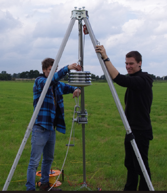
Falling Weight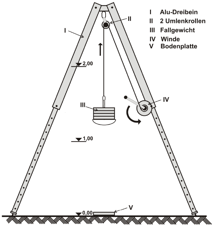
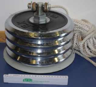
In the course of a Bachelor thesis, a source with a falling weight was designed and built (Frielinghaus, 2014) for up to 60 kg? This allows higher energy and deeper penetration and thus could be used for reflection seismic imaging on land.
Up to 4 pieces of 10 kg weights can be attached, and the dropping height can be up to 1.5 meters. The calculated energy is 662 Joule.
As shown in the frequency spectrum from a field experiment, a frequency range between 5 and 100 Hz can be reached, with a peak energy 30 and 40 Hz, depending on the total weight. Compared to a hammer as a source (green line) mostly frequencies below 40 Hz are enhanced, thus supporing deeper penetration.
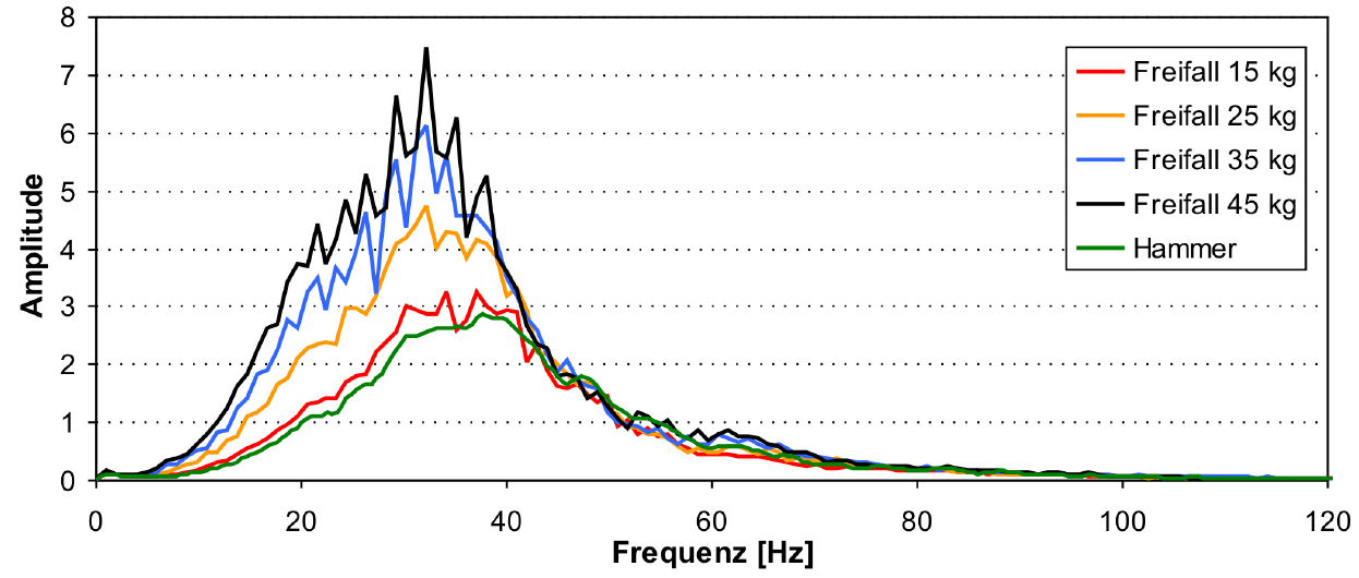
Spectrum of Hammer seismic signals and different weights of the falling weights.
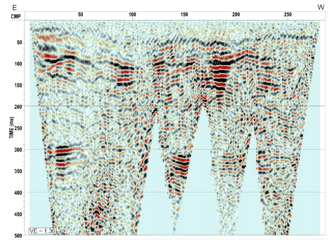
Data example from a field survey
with the falling weight over a
salt dome near Buxtehude.
Land Seismic Acquisition
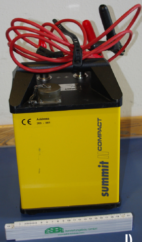
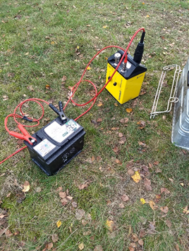
 For the acquisition of seismic data, we are using two “SUMMIT II Compact” (DMT) as seismographs. Each of them can acquire 24 channels and are linked together with a simple ”Snap-On” line cable to comprise a 48-channel seismic acquisition system. They are coming in a light, solid waterproof housing deployable in any environment and can be driven with normal car batteries. A USB Line Interface is used to connect them also via a “Snap-On” line cable with a Panasonic Toughbook for controlling the units and storing the data. This “Snap-On” system makes the assembling of the system very flexible. The design of the geophone cable allows a maximum distance of 5 m between the geophones. The data acquisition is triggered by an acceleration sensor attached to the hammer.
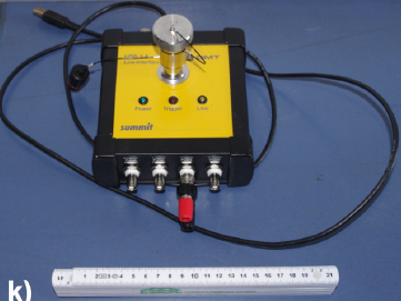
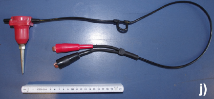
Elements of the land acquisition system. From left to right:
Vertical geophone, connector box, Summit II compact acquisition system
 Some technical specifications of SUMMIT II Compact:
Sample interval | 1/48 – 8 ms |
Record Length | Up to 120k samples |
Preamp Gain | 0, 20, 40 dB |
A/D converter | 24 bit |
Dimensions | 20 x 15 x 29 cm |
Weight | 4.9 kg |
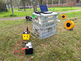
SUMMIT II compact (bottom) connected via USB interface to a Panasonic Toughbook (both on the Zarges Boxes) and to a battery. Yellow cables on drums are the data and trigger cables using the “Snap-On” system (not connected yet). The red cable in the front connects the 24 geophones to the acquisition system. Measurements were done along the “Kuhgraben” close to the University Bremen.
SUMMIT II compact unit connected to a battery
and to 24 geophones via the red cable to the left.
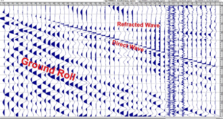
Typical example of a Hammer seismic shot acquired in Borgfeld. Geophone distance is 0.5 m,
record length is 0.25 s. Clearly visible are the direct wave and the wave refracted at the
groundwater table. Note the strong ground roll (surface waves). Three channels are noisy
due to bad connection to the soil as a result of strong root vole activity in the area.
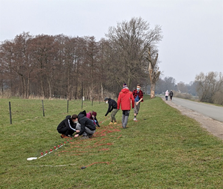
Students preparing the geophones in Borgfeld during the field
practice of the course “Methods of Geophysical Exploration.”
Ground Penetrating Radar (GPR)
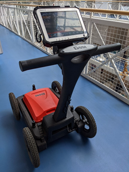 Since 2017 our working group hosts a Ground Penetrating Radar (GPR) for student projects. Our GPR is the UtilityScan® DF from the company GSSI. GSSI is the market leader for GPRs. The UtilityScan® DF is a dual frequency digital GPR unit and incorporates an innovative 300/800 MHz DF antenna and an easy-to-use touchscreen interface to view shallow and deep targets simultaneously in a single scan.
While the 800 MHz antenna i3ages the upper meter in high resolution, the 800 MHZ antenna penetrates the subsurface down to 5 meters. With these specifications, our GPR is an ideal tool for terrestrial soil investigations, archaeological and geological prospection, but also for detection of metallic and non-metallic objects like gas, communication or sewer lines as well as underground storage tanks and PVC pipes in various soils.
GPR system Utility Scan DF (GSSI)
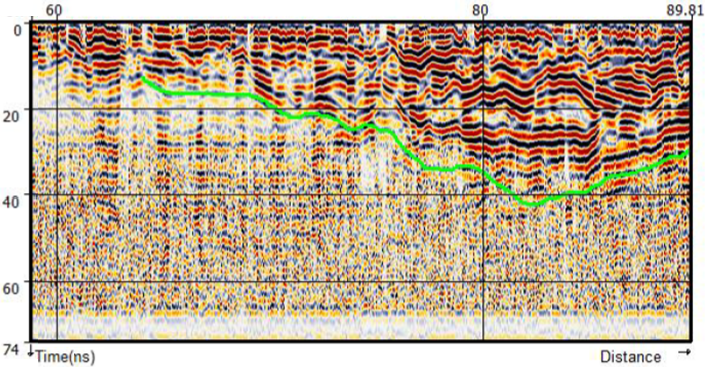
2-D GPR Profile from Bremen Mahndorf showing an abandoned Weser river arm filled with river sands.
 For processing and interpretation, the software packages RADAN for UtilityScan® (GSSI) and REFLEX-W GPR/reflection seismics 2D/3D (Sandmeier geophysical research) are available.
Several projects have been done so far in cooperation with the Landesarchäologie Bremen (Archaeological Survey Bremen).
One highlight was the mapping of an abandoned Weser river channel in Bremen Mahndorf where it is supposed that human settlements existed between AD 200 and 400 along it banks.
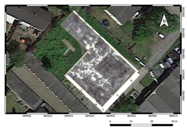
Another important project was the localization of a barrack for prisoners of wars tortured as labor slaves in the last years of WWII in Bremen Gröpelingen (“Schützenhof”). .
Currently, students are carrying out a project at the area of the assumed Varus battle field between Germans and Romans some 2000 years ago.
Topview of a 3D GPR dataset showing the fundaments of a former barrack in Bremen Gröpelingen
(black rectangular area)