
Sustainability
What is the contribution of geophysics / seismo-acoustics to fight climate change?
Wherever resources of the Earth's interior are to be exploited or constructions are planned on or within the seafloor, site investigations and resource evaluations are needed.
We are heavily involved in the site investigations for wind farms and we are also doing some research on geologic storage structures and processes, which may be used for CO2 or hydrogen.
Also we are developing methods and approaches to improve seismic data acquisition and processing at sea, which are particularly relevant for renewable energy plants, such as the detection of boulders and cables. Also we work on a better quantification of soil properties using seismoacoustic data, to speed up development times for offshore wind power farms.
How did we get involved?
Geophysical investigations are key for soil characterization, but in shallow water, appropriate technologies, approaches and data processing schemes were not available in 2003. Therefore we have initiated in 2003 a workshop with windfarm developers, engineers and goverment institutions to promote quality measures and improve the use of seismic data for quantitative soil investigations. Since then, we have strongly improved academic efforts and supported since 2010 also the built-up of a geophysical group at Fraunhofer IWES, which directly cooperating with windfarm industry. This lead to a strong group of >25 professionals, leading windfarm survey work in Europe.
Jointly, we have been successfully applying for 4 different applied research projects funded by Ministry of Economy.
What are our achievements at this point?
In our BMWi Project Seismik NordOst we have carried out research on the suitability of seismic sources, recording equipment and survey approaches. The intent was to provide a guideline for future survey work and to optimize time, costs through selecting the best seismic equipment. Comparisons were made between single and multichannel acquisition, analog and digital streamer and between sources such as different boomers, bubble gun, sparkers and airguns. Depending on lithology and depositional settings, choice of equipment has to be adjusted. For example, while in the North Sea, mostly sandy, but unconsolidated sediments dominate the upper several hundred meters, in the Baltic Sea glacial till and bedrock dominate within the range of foundations. As a consequence, signals are strongly attenuated and lower frequencies and higher energy need to be generated.
The BMWi Project Boulder Detection was proposed to develop a new method to detect boulders deep in the subsurface, using seismic frequencies. This project succeeded to the submission of two patents on our seismic frame, and several request from commercial partners have been made since then to apply surveys. The approach is basically used for a risk assessment, not necessaritly for a perfect localization of all boulders. Adjustments of installation methods or foundation types may be chosen based on a high risk boulder analysis.
Our ongoing BMWi Project SynCore is designed towards a better quantification of subsoil properties. We are currently exploring the numerical effects of acquisition on seismic data, such as towing depth, group spacing, frequency and streamer design. Also we are looking into a better use of geologic interpretation data to constrain soil modeling, as so far the knowledge of known or predicted lithology is not properly incorporated.
The ongoing BMWi Project SASACD targets the detection of cables with acoustic methods. It should provide a method, which differs from magnetic surveying, where power cables need to be switched off. Acoustic methods instead should avoid this and therefore reduce costs significantly. Also, we expect a high precision in localization and burial depth by using a seismic frame similar to 'Boulder Detection', but downscaled to the size of cables.
What are the future needs?
With the necessary acceleration of wind farm development, all processes in the development chain need to be carefully analyzed.
From the geophysical point of view, which comes very early, one of the deficits is that at the time of the survey, the location of windmills is likely not known. It takes several years between survey and installation, and in the meantime, size of turbines likely changes and thus distance between WEA locations. An optimum seismic survey would therefore allow relocation of WEAs at any time, and in consequence a very high density grid or even 3D seismic surveys. If spatial resolution of such grids is only a few meters, WEAs can easily positioned at any location within the farm.
We therefore look for options for 3D seismic surveying to confirm that such data are only reasonably more expensive, but the gain in flexibility speeds up the development process. This has yet to be confirmed by a new project.

How does our work fit into SDG: the Sustainable Development Goals?

 As a working group at a university, we are very much committed to improve education on various levels. Among those, we are strongly involved in international teaching at Bremen University in english language, both in the new bachelor program in Marine Geosciences as well as our masterprograms in Marine Geosciences and Applied Geosciences. We welcome international students at the department of geosciences since more than 15 year and have given degrees to many of thos students. We like to work in teams, both for teaching, in our research group and of course through internation cooperation such as the International Continental Drilling Program or the Ocean Drilling Initiatives. Among the 85 theses, 29 of them (34%) were carried out by visiting students.

 Clean Energy has been a focus of our working group since the very beginning. We understood our initiatve to develop shallow water seismic approaches to lay the path for future developments, such as offshore installations and windfarms. We had been quite sucessful also to implement new technologies, and during the built-up of the soil investigation group at Fraunhofer IWES we also successfully incorported these technologies in applied research and commercial survey work.

The ocean is the main medium, marine geophysics deals with. While doing research on many expeditions, we always intended to contribute to a better understanding of present and past environmental conditions, processes in the ocean and evaluation of climate. Paleoclimatic and paleoceanographic studies led to drilling expeditions, which provided to the global understanding of how the climate systems works and which critical changes had global implications.
 While seismic method and acoustic invenstigation generate loud sound waves, we have working on reducing them constantly , lowering the impact of noise on marine life and by monitoring their presence during data acquisition. However, if wind farms are to be installed offshore, seismic data are crucial and signficantly help lowering future impact on nature.
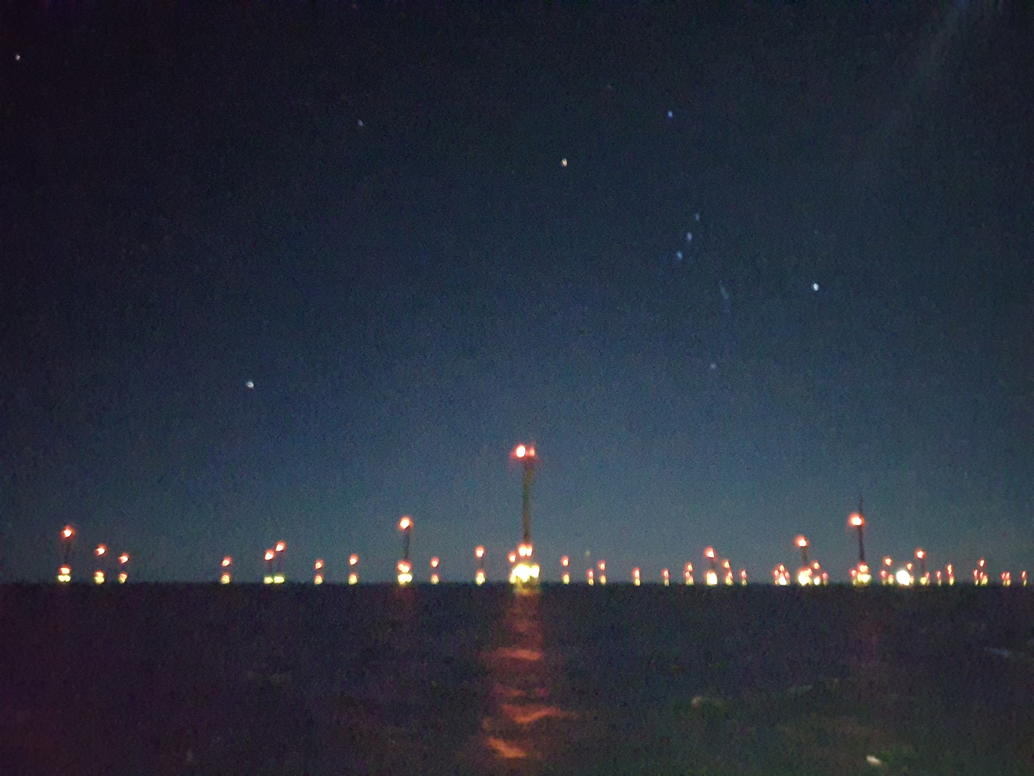
Wind Farm in Baltic Sea surveyed by MTU & IWES in 2013
Starting with a new (partially english) Master Program on Applied Geosciences,in WS 2021, we included applied topics into our curriculum, namely two modules on renewable energies. This is a joint effort of GeoB and Fraunhofer IWES, including wind, ocean and waves, solar, hydroelectric and geothermal energy exploitation.
In summer term, we then focus on wind farm developments and the needs for geophysical, geologic and geotechnical as well as environmental investigations and regulatory boundary conditions. Projects on various topic complete the program. Complimentary modules could be Engineering Eeology, Applied Geophysics or Geohazards.
Since 2003, MTU has developed technology and approaches, which were suitable to acquire high quality multichannel seismic data in shallow water. Initiating a BSH standard for wind farm surveying, MTU has been involved through cooperation with wind farm developers, BSH, LUNG and Fraunhofer IWES to promote better and more efficient geophysical soil investigations.
North Sea & Baltic Sea Geology
The German national waters and EEZ (exclusive economic zone) became a focus of wind farm developemnt in recent years.
Among the regions, which were of interest and target of wind farm development, MTU investigated German and Danish North Sea, German, Danish and Polish Baltic Sea and the Irish Sea.. Due to the interaction of Northern Hemisphere Glacian, Sea Level Change, Glaciofluvial and Fluvial Overprint and Shallow Marine Sediment Transport and Deposition Processes, German Waters are among the most complex geologic environments.
As part of our research activity within RCOM, MARUM as well as through cooperation with BGR, BSH, Fraunhofer IWES and various companies, we surveyed potential wind farm areas to gain a better understanding of the soil condition, starting in 2004.
Geotechnical Data and Soil Modeling
Overview of geologic processes and themes we have covered in various projects, expeditions and publications
Carbon Caputure and Storage (CCS)
While this is not a main topic of our research yet, the seismic method is particularly suitable to identify reservoir characteristics both in sediments and oceanic crust, which could be suitable for carbon storage.