
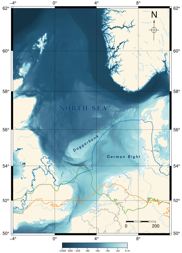
North Sea, Ireland
Involvement of MTU in North Sea Research since 2004
The German sector of the North Sea became our research target in 2003. At this time we had purchased our first single hydrophone streamer and were thus able to improve seismic imaging in shallow water significantly. Spatial resolution of 1 meter could be achieved due to a group spacing of only 1 m (conventional systems had 3.125 m, 6.25 m or more), but at the same time we could also reduce shot intervals to a few seconds (from 10 s or more) due to the use of the custom-made seismic acquisition system MaMuCS and data storage on hard disk rather than tapes.
Also, the high-frequency watergun (Sodera S-15) and later a mini GI Gun (2 x 0.2 L) or micro GI Gun (2 x 0.1 L) were used and emitted frequencies were significantly higher than for a conventional airgun. Based on these instrumental improvements, we started shallow water seismic investigations, with a focus of the North Sea and Baltic Sea in the first place.
A strong cooperation on North Sea research was established within MARUM with AG Mörz (Marine Engineering Geology, GeoB) and Senckenberg am Meer Institute in Wilhelmshaven (Marine Sedimentology) in Subproject Dx (Link).
Research in the deeper parts of the German sector of the North Sea with geological or geophysical approaches was in the responsibility of NlfB (Niedersächsisches Landesamt für Bodenforschung), the Geological Survey of Lower Saxony, which merged in 2006 into LBEG (Landesamt für Bergbau, Energie und Geologie). Acitivites had been very limited before year 2000 with very few boreholes and no deeper penetrating seismic data acquired. Only Boomer sources had been used for single channel seismic investigations, mostly by BSH (Bundesamt für Seeschifffahrt und Hydrographie)
The BGR (Bundesanstalt für Geowissenschaften und Rohstoffe/Federal Institute of Geosciences and Resources), being an institution under the lead of the BMWi (Bundeswirtschaftsministerium/ Ministry of Economics), established a research focus on the German national waters and EEZ (Exclusive Economic Zone/AWZ)
In particular for the preparation of the economic use of the German North Sea, e.g. for the construction of windfarm, the project GPDN (Geopotenziale Deutsche Nordsee) was compiling between 2009 and 2013 all available geo data.
In the course of this, cooperation was decided between BGR, MARUM and MTU, to provide existing seismoacoustic data to GPDN as well as jointly collecting data on BGR research cruises. of MTU members participated on several cruises such as Aurelia (2004), Senckenberg (2005), Franklin (2007), Celtic Explorer (2011).
Since 2001, MTU has developed a strong opinion on future development of the North Sea for the installation of wind mills. Accordingly, the technology and approaches for shallow marine multichannel seismics were developed since then. In 2003 the first academic single hydrophone streamer was purchased which allow much higher resolution and higher frequencies than conventional systems.
In the course of the excellence cluster funding programs RCOM and MARUM, for more than a decade research was carried out in the North Sea, closely cooperating with colleagues from shallow marine geology and engineering geology. Several joit criuses were carried, both supported by GPDN and BGR as well as research cruises.
Also semi-commercial projects were carried out in particular to utlize the wealth of ground-truthing data, which are typically collected in the vicinity of foundation locations, namely CPT probes and boreholes. In cooperation with AG Mörz and the companies Geoengineering GmbH, Innogy SE, E.On, ENOVA and Plambeck Neue Energien (PNE), several potential wind farm areas had been surveyed with multichannel seismic. Our goal to improve data quality beyond the use of inappropriate boomer systems led to the development of a new survey standard by BSH, where requirements for data quality were defined similar to the state of work established by MTU.
Cruises SK05, FR07, SK08, SC09 and CE11 were partially related to wind farm surveying, and in the following years, these data were extremely useful to study small scale variation of lithology, depositions units and processes and fluvial and tunnel valleys. They revealed a complex subsurface, which is still today a topic for research projects. Also they serve as a basis for more applied research we are carrying out through funding of BSH the carry out pre-site survey and providing a framework for regional seismic interpretation concepts.
In 2017, we extended our cooperatiopn to partners working in the Irish Sea, namely iCRAG (Prof. Dr. Andrew Wheeler, University College Cork), and jointly carried out a research cruise with Celtiv Voayer (CV17013) to collect multichannel seismic data along the coastal of the Irish Sea in designated windfarm areas.
Following we provide a brief summary of the previous and ongoing research, which to a larger extent was carried out through master thesis, dealing with different details of the North Sea sedimentary evolution.
Research Themes
Sealevel History
Fluvial, Subglacial and Glaciomarine Deposition and Erosion
Glaciotectonics
Salt Tectonics
Soil Investigations
Contribution through RCOM and MARUM
Contribution through BMWi Funding
SNO
Boulder Detection
SynCore
Cable Detection
Contributions through SEBAMO (BSH)
Source Dependancy of Facies and Resolution
Tunnel Valleys
Glacial Impact
Salt Tectonics
Related Projects and Web Pages
- BGR Partner Project 'Nordsee' )2002 - 2012)
- BGR Partner Project 'GPDN - Geopotenziale Deutsche Nordsee'
- BSH Partner Project SEBAMO-I (2018-2023)
- BSH Partner Project SEBAMO-II (2022-2025)
Research Cruises
- 2004 - Aur04 - Aurelia - (BGR)
- 2005 - He242 - Heincke (BGR) - 01.11.-14.11.2005
- 2005 - SK05 - FK Senckenberg - (BGR)
- 2007 - FR07 - Franklin - (BGR)
- 2008 - SK08 - FK Senckenberg -
- 2009 - SC09 - MS Schall
- 2011 - CE11 - Celtic Explorer - (BGR)
- 2014 - SC14 - MS Schall (GeoE)
- 2013 - He405 - Heincke - 27.06-13.07.2013
- 2016 - He463 - Heincke - 11.05-27.05.2016
- 20xx - AT241 - Atair (BSH) - 20xx
- 2017 - AT251 - Atair (BSH) -
- 2018 - WG173 - Wega (BSH) -
- 2019 - He525 - Heincke - 05.03-08.03.2019
- 2019 - AT274 - Atair - (BSH) -
- 2021 - He569 - Heincke - 04.02-26.02.2021
- 2021 - MSM100 - Merian (BGR)
- 2021 - AT009 - Atair(IV)
- 2022 - AT014 - Atair(IV) (BSH) -
- 2023 - ATxxx - Atair(IV) - BSH
weiter
Publications
Andresen, Katrine Juul, Hepp D.A., Keil H., Spiess V. (2022) Seismic morphologies of submerged late glacial to early Holocene landscapes at the eastern Dogger Bank, central North Sea Basin – implications for geo-archaeological potential
Özmaral, Asli, Abegunrina A., Keil H., Hepp D.A., Schwenk T., Lantzsch H., Mörz T., Spiess V. (2022) The Elbe Palaeovalley: evolution from an ice-marginal valley to a sedimentary trap (SE North Sea)
Tóth, Zsuzsanna, McCarron S., Wheeler AJ., Wenau S., Davis S., Lim A., Spiess V. (2020) Geomorphological and seismostratigraphic evidence for multidirectional polyphase glaciation of the northern Celtic Sea. Journal of Quaternary Science 35, 465-478, https://doi.org/10.1002/jqs.3189.
Wenau, Stefan, Alves T. (2020) Salt-induced crestal faults control the formation of Quaternary tunnel valleys in the southern North Sea. Boreas. http://dx.doi.org/10.1111/bor.12461.
Oguro, Aisgo W.O., V Spiess V. (2017) Quantitative Interpretation of Shallow Sediments through Seismic Elastic Inversion. 23rd European Meeting of Environmental and Engineering Geophysics 2017, 1-5, https://doi.org/10.3997/2214-4609.201702099. (PDF)
Özmaral, Asli (2017) Climatically controlled sedimentary processes on continental shelves. Dissertation, xx. pp.. https://media.suub.uni-bremen.de/bitstream/elib/1355/1/00106314-1.pdf.
Gehrmann, Romina, Dettmer J., Schwalenberg K., Engels M., Dosso SE., Özmaral, A. (2015) Trans‐dimensional Bayesian inversion of controlled‐source electromagnetic data in the German North Sea. Geophysical Prospecting, 63, 1314 - 1333, https://doi.org/10.1111/1365-2478.12308.
Hepp, Daniel A., Hebbeln D., Kreiter S., Keil H., Bathmann C., Ehlers J., Mörz T. (2012) An east–west-trending Quaternary tunnel valley in the south-eastern North Sea and its seismic–sedimentological interpretation. J. Quaternary Science, 27, 844-853, https://doi.org/10.1002/jqs.2599.
Hempel Peter, Spiess V., Schreiber R. (1994) Expulsion of Shallow Gas in the Skagerrak – Evidence from Subbottom Profiling, Seismic, Hydroacoustical and Geochemical Data. Estuarine Coastal and Shelf Science, 38, 583-601, https://doi.org/10.1006/ecss.1994.1040.
Master Theses
Ajibola, Damilola (2023) Neogene Evolution of the southern North Sea
Cammarata, Daniel (2022) Systematic Comparison of Multiple Suppression techniques on High-Resolution Data
Omiyale, Eniola (2021) Interpretation of an Observed Valley Structure, Based on the Processing of High-Resolution 3D Data Acquired from the North Sea
Farag, Mohamed (2021) Facies Mapping of a Quaternary Tunnel Valley Infill - North Sea
Ramadan, Abdelrahman Mosaad (2021) Seismo-acoustic facies Source Dependency, a comparative study of different seismic source and interpretation implications, North Sea
Sierra, Gabriella (2020) Impact of Salt Tectonics and Glaciations on Sedimentation in the North Sea
Dodds, Samuel (2020) Facies classification and distribution of Quaternary sediments in the German North Sea
Schwab, Arne (2012) Morphology of tidal flats a new detection approach with hydroacoustic and optical remote sensing techniques
Szocko, Lukas (2009) Seismic Interpretation North Sea Wind Farms
Fürle, David (2009) Erstellung einer Baugrundkarte auf Basis von Sedimentkernanalysen kombiniert mit seismischen Profilen
20.03.2018
Dr. Katrine Juul Andresen (Department of Geoscience, Aarhus University)
PALEOLANDSCAPE INVESTIGATIONS IN THE CENTRAL NORTH SEA
Conventional 3D and high resolution 2D seismic data from the Danish Central Graben have been used for mapping several generations of buried valley systems. The oldest valley system is interpreted to have formed sub-glacially during the Saalian ice cover, while the youngest system is suggested to represent the proglacial to fluvial transition phase after the Weichselian ice retreated and prior to the Holocene marine transgression. The mapped valley systems highlights the Saalian and Late Weichselian to Early Holocene development of the Central North Sea and may be linked to Paleo-Elbe Valley further east.
Hosted by: Dr. Hanno Keil and Dr. Daniel Hepp