
3D High-Resolution Multichannel Seismic Surveys
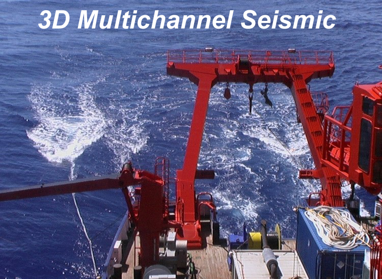
 Threedimensional seismic surveying makes use of very dense data collected in a way that the spatial resolution becomes similar along track as well as across track. This allows to image spatially complex geologic structures, but it requires much more time for acquisition and much more efforts for data processing and navigation. While this is an established for Oil and gas exploration since 30 year, it is rarely used in academia. And the industrial technology is much more advanced, since many streamer (10 or more) of several (up to 12) km long streamer are towed in parallel. For high-resolution seismic work in academia, this has not been possible due to limited funds and limited performance of acquisition technology (cable bandwidth etc.) in general.
In the last two decades since 2000, the MTU working group has gained a worldwide leadership in high-resolution 3D seismic surveying, having carried out 14 dedicated surveys for different scientific objectives and two other approaches were developed to gain threedimensional seismoacoustic images for flare imaging and subsurface diffraction imaging. No other academic group has yet gained more experiences not only with the acquisition, but also with respect to processing and interpretation.
Most of the MTU survey were carried out in a 2.5D scheme, with just a single source and single streamer, shooting lines at narrow spacing of 25 meters. However, one MTU survey was acquired with 2 sources triggered in an alternating mode (Costa Rica 2002) and another survey with 2 shorter streamers (300 m) and 2 sources were acquired such that an across-track resolution of 6.25 m could be achieved.
Only recently, two true 3D survey could be carried in Baltic Sea (2017) and North Sea (2018) with 4 streamers and 2 sources, so that 8 CDP lines could be acquired. However, at this experimental stage, only short streamers of 50 meters were used. This approach needs to be further developed to more and longer streamers.
Among the scientific themes, we concentrated on complex geologic structures, which can better understood with threedimensional imaging or need spatial imaging due to high variability, such as fluid and gas seepage through faults and pockmarks, hydrothermal circulation, mud and salt diapirism, caldera formation, mass wasting and glacial deformation.
Cascadia Margin (2000)
SO149 Sonne, Bullseye Vent, Gas Hydrates and Seepage
Cascadia Basin (2000)
SO149 Sonne, Hydrothermal circulation, fluid seepage and compaction-induced forced folding
Middle Valley (2000)
SO149 Sonne, Sulfide ore formation in a hydrothermally overprinted sedimentary setting
Costa Rica (2002)
M54-1 Meteor, Mud volcansm on a tectonic erosive margin
Black Sea (2002)
M52-1 Meteor, Sevastopol mud volcano on an accretionary ridge
Black Sea II (2007)
M72-3b Meteor, Batumi seepage site, gas hydrates and fracturing
Congo Pockmarks (2002)
M56 Meteor, Hydrate and Black Hole seepage induced by salt diapirism
Bengal Fan (2006)
SO188 Sonne, Rapid changes in a strongly meandering channel-levee setting
Gulf of Pozzuoli - shallow (2008)
Urania, Campi Flegrei Caldera Evolution - shallow history
Gulf of Pozzuoli - deep (2016)
Minerva, Campi Flegrei Caldera Evolution - collapse history and volcanic and structural framework
Ligurian Margin - Nice Airport Slide (2016)
POS500 Poseidon, Nice Airport Slide Complex
Baltic Sea Pockmarks (2014)
AL446, Pockmarks in Arkona Basin
Baltic Sea (2017)
AL490-1 Alkor, Glacial deformation, valley formation and Holocene sedimentation history in the vicinity of Baltic Sea wind farm areas
North Sea (2018)
Shallow sedimentary setting in a wind farm area
Using narrow beam echosounder data, a threedimensional picture of water column structure can be derived from station work and small scale dedicated surveys
If a two-dimensional array of hydrophones is used, and not just a single streamer, the antenna properties of such setup can be used for directional enhancement of energy, similiar to multibem systems for acoustic imaging. With this approach, particularly diffractions can be detected along a swath around the track, such that a subsurface cube is generated. Main application is boulder detection for risk assessment in wind farm area. The concept has been developed within a joint MTU-IWES project mainly from MTU contributors and patented later jointly.

Publications
Wenau, Stefan, Spiess V., Keil H., Fei T. (2018) Localization and characterization of a gas bubble stream at a Congo deep water seep site using a 3D gridding approach on single-beam echosounder data. Marine and Petroleum Geology 97, 612-623, https://doi.org/10.1016/j.marpetgeo.2018.07.016. (PDF)
Wenau, Stefan, Stange N., Keil H., Ramos C., Spiess V. (2018) A Seismic Beamforming Approach for the Detection Of Boulders in the Shallow Sub-Seafloor. 3rd Applied Shallow Marine Geophysics Conference 2018 (1), 1-5, https://doi.org/10.3997/2214-4609.201802672. (PDF)
Steinmann, Lena, Spiess V., Sacchi M. (2018) Post-collapse evolution of a coastal caldera system: Insights from a 3D multichannel seismic survey from the Campi Flegrei caldera (Italy). Journal of Volcanology and Geothermal Research 349, 83-98, https://doi.org/10.1016/j.jvolgeores.2017.09.023. (PDF)
Wenau, Stefan, Spiess V., Pape T., Fekete N. (2017) Controlling mechanisms of giant deep water pockmarks in the Lower Congo Basin. Marine and Petroleum Geology 83, 140-157, https://doi.org/10.1016/j.marpetgeo.2017.02.030.
Steinmann, Lena, Spiess V., Sacchi M. (2016) The Campi Flegrei caldera (Italy): formation and evolution in interplay with sea-level variations since the Campanian Ignimbrite eruption at 39 ka. Journal of Volcanology and Geothermal Research 327, 361-374, https://doi.org/10.1016/j.jvolgeores.2016.09.001.
Steinmann, Lena (2016) Reconstruction of volcano-tectonic processes in interplay with sedimentary deposition in the Gulf of Naples (Italy) using a seismoacoustic dataset. Dissertation, xx. pp.. https://media.suub.uni-bremen.de/bitstream/elib/1114/1/00105516-1.pdf.
Wenau, Stefan (2013) Seismic and acoustic imaging of fluid seepage structures in different sedimentological and tectonic settings in the Lower Congo Basin. Dissertation, xx. pp.. https://media.suub.uni-bremen.de/bitstream/elib/550/1/00103442-1.pdf.
Wagner-Friedrichs, Michelle, Krastel S., Spiess V., Ivanov M., Bohrmann G., Meisner L. (2008) Threedimensional seismic investigations of the Sevastopol mud volcano in correlation to gas/fluid migration pathways and gas hydrate occurrences in the Sorokin Trough (Black Sea). Geochemistry, Geophysics, Geosystems, 9, Q05012, https://doi.org/10.1029/2007GC001685 .
Wagner-Friedrichs, Michelle (2007) Seafloor seepage in the Black Sea: Mud volcanoes, seeps and diapiric structures imaged by acoustic methods. Dissertation, 154 pp..https://media.suub.uni-bremen.de/bitstream/elib/2356/1/00010674.pdf
Zühlsdorff, Lars, Spiess V. (2006), Sedimentation patterns, folding, and fluid upflow above a buried basement ridge: Results from 2-D and 3-D seismic surveys at the eastern Juan de Fuca Ridge flank, J. Geophys. Res., 111, B08103, https://doi.org/10.1029/2004JB003227 .
Zühlsdorff, Lars, Spiess V. (2005) Three-dimensional seismic and acoustic imaging of gas migration and gas hydrate accumulation beneath pockmarks in hemipelagic sediments off Congo, South-West Africa. In: Proceedings of the fifth international conference on gas hydrates (ICGH 5), Norway, 10 pages. (PDF)
Zühlsdorff Lars, Spiess V. (2004) Three-dimensional seismic characterization of a venting sites reveals compelling indications of natural hydraulic fracturing, Geology, 32: 101-104, https://doi.org/10.1130/G19993.1.
Master Theses
Omiyale, Eniola (2021) Interpretation of an Observed Valley Structure, Based on the Processing of High-Resolution 3D Data Acquired from the North Sea. MSc Thesis.
Singh, Rashpal (2019) Processing and Interpretation of 3D high-resolution multichannel seismic data from offshore Nice, Southern France. MSc Thesis.
Römer-Stange, Nikolas (2018) Imaging point diffractions with beamforming methods – Evaluation of acquisition geometries, development of an algorithm, application to synthetic and real marine seismic data sets. MSc Thesis.
Marinkovic, Henning (2017) Processing and interpretation of a three-dimensional highresolution multichannel seismic dataset from the Batumi Seep Area, Eastern Black Sea. MSc Thesis.
Koletzek, Arnold (2016) Die dreidimensionale Abbildung einer Überdruckzone im Bullseye Vent am Cascadia Kontinentalrand MSc Thesis.