
2007 08 - M73-1 - Ligurian Margin - Nice Airport Slide - Seismic Part
22.07.-11.08.2007: Cadiz (Spain) - Nice (France) - Nice (France) - Genova (Italy)
M73-1B - Seismics: 30.07.-06.08.2007: Nice (France) - Nice (France)
 Working Area: Ligurian Margin - Shelf and Slope
Chief Scientist: Dr. Kopf
Chief Seismic: Dr.Spiess
MTU Participants: Krastel,..
Cruise Report,
Groups involved
- Working Group Geotechnik, AG Kopf, Forschungszentrum Ozeanränder (RCOM) Bremen
- Working Group Marine Technology/Environmental Research, Department of Geoscience, Bremen University (GeoB AG Spiess (MTU))
- Ifremer, Plouzane, France
- Geological Institute, ETH Zürich, Switzerland
Instrumentation
- GI Gun 2 x 0.4 L (Generator-Injector; Sodera/Sercel)
- GI Gun 2 x 1.7 L ( Generator-Injector; Sodera/Sercel)
- Arstech Streamer 50 m, 48 channels, single hydrophones, 1 m spacing
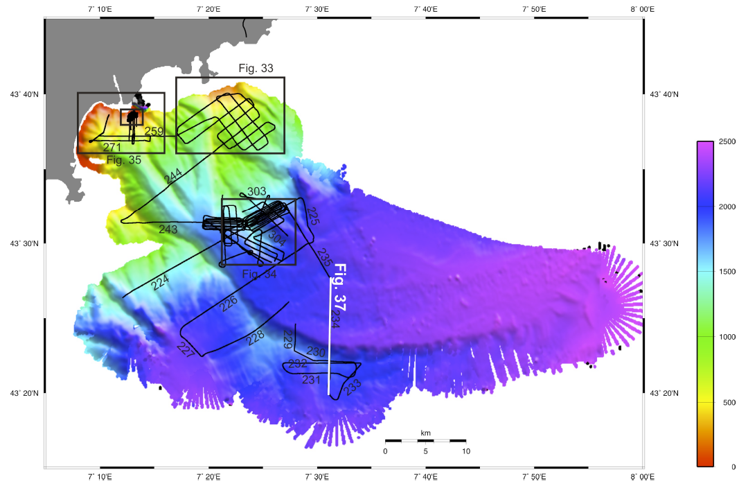
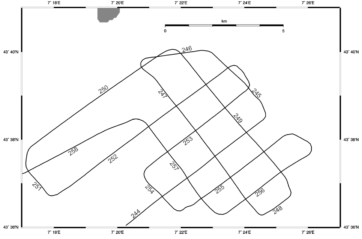
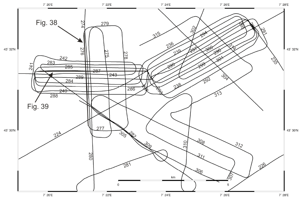
Bathymetry and seismic tracks at the Ligurian Margin. Deep water surveys targeted the Var Canyon
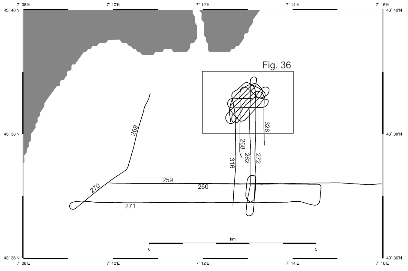
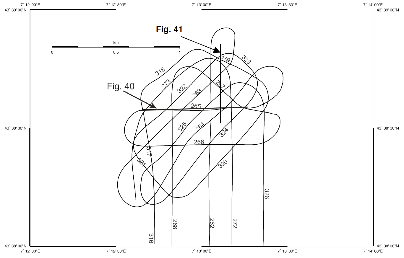
Survey Nice Airport Slide Upper slope seismic survey lines off Nice
 Cruise M73/1 “LIMA-LAMO” with R/V Meteor studied the western Ligurian Margin off Southern France. This area in the northeastern part of the western Mediterranean Sea represents a tectonically active margin with a lot of microseismicity and mass wasting. Landslide processes, turbidites, and other consequences of slope instability were the aim of this RCOM expedition into the area of Var Canyon and turbiditic system and the Baie des Anges, both located south of Nice at the French Riviera. The study area can be divided into five regions:
- The Nice airport slide and adjacent stable slope in 15-300 m water depth;
- The mid-slope with both ridges and gullies where the landslide mass was traveling, including some unaffected stable slope regions, all in 500-1000 m water depth;
- The deeper slope (1500-2000 m water depth) adjacent to the Var Canyon with landslide scars and talus (“western slide”);
- An even larger slide complex further away from the canyon system (“eastern slide”); and
- The Var Canyon region with its flanks, terraces, and channels in down to approximately 2500 m water depth.
Foot of Slope landslide survey Upper slope seismic survey east off Nice
 Nice Airport Slide
As being related to a drilling proposal, the area around the Nice Airport Slide, which occurred in 1979 and destroyed part of a construction to extend the airport seawards, was studied with a dense grid of lines to determine typical features such as gliding planes, weak layer, shelf sedimentary sequences and internal structures to locate sites for future monitoring and scientific drilling. The seismic example shows
Var Canyon
At that time the Var Cynaon and surroundings were part of a French IODP pre-proposal, and further seismic data intended to support this initive with some longer lines at the outflow region of the canyon. Seismic structure reveal quite an interesting asymmetry
Eastern Slope
As a comparison to the slide area, several seismic lines were shot on the eastern slope which shows much less indication of mass wasting and slope failure. The survey intended to reveal possible differences in sediment composition and structure.
Landslide Areas
The landslide area at the foot of the slope was studied in greater detail also with coring and CPT measurements to get a better handle on the origin and nature of the slope instability. It seemed from multibeam data that the feature indicate retrogressive failure, which start at the base and then migrate upslope event by event.
Slope-parallel eismic line across the slide area off the Nice Airport Deep water seismic lines across the Var Canyon and its western flank

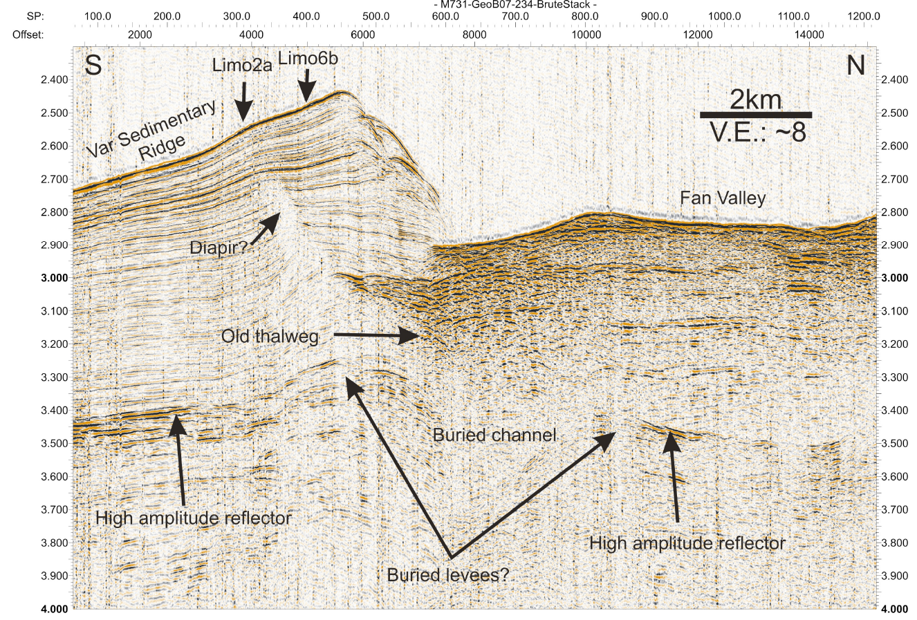
Table of seismics lines of Cruise M73/1B


