
Traunsee, Austria
Volkhard Spieß, Hanno Keil
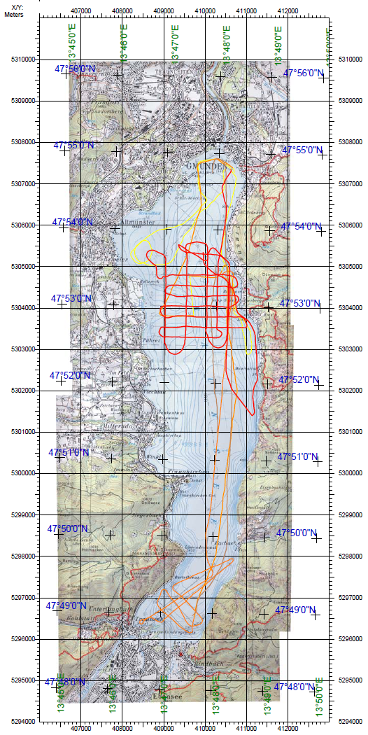
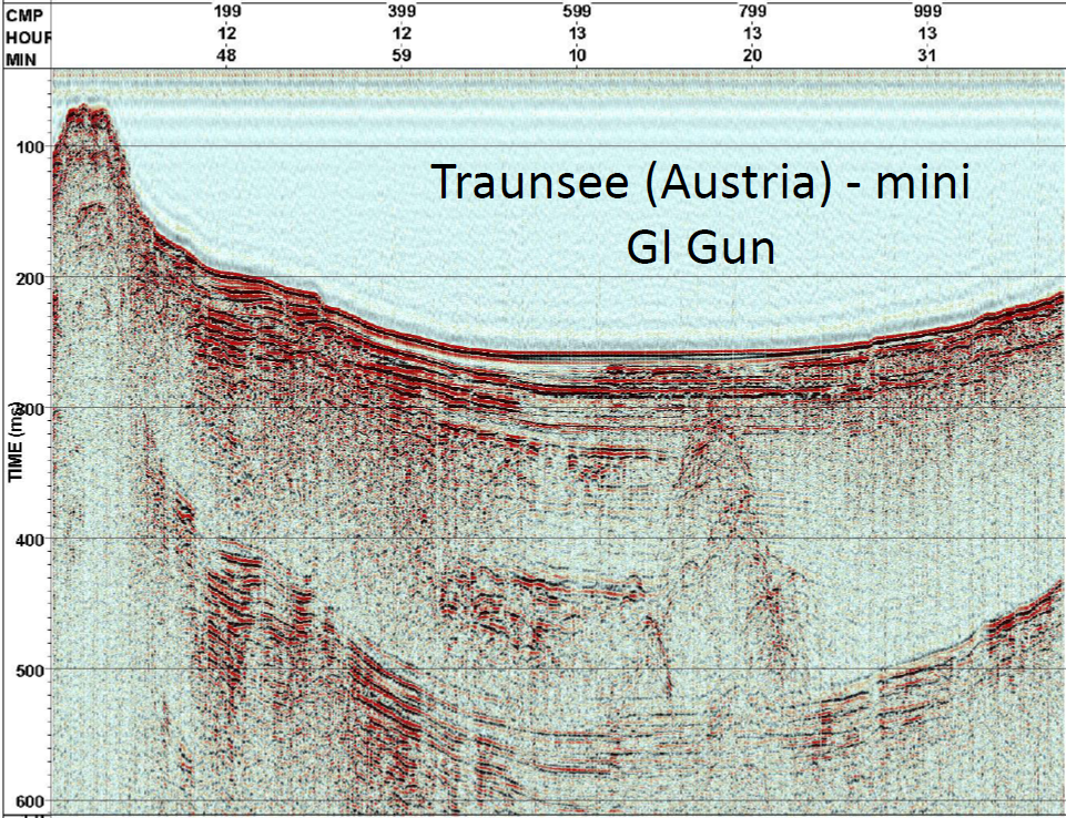
The Traunsee Lake Survey Project was initiated by the University of Leoben (Prof. Dr. Karl Millahn) in 2004. It was part of geophysical investigations of a particularly sensitive area of slope instability on land, the Gschliefgraben. The area is actively moving and thus poses a risk for inhabilitants. The unknown part of the unstable slope in the lake was now to be investigated to study processes at the foot of this area, which reached from about 700 m above lake level to the floor of the lake at -134 m.The survey was funded by the Österreichische Akademie der Wissenschaften, the University of Leoben and MTU. It was carried out from 28.2.05 to 2.3.05 on the tourist vessel 'Karl Eder'. Besides a sidescan sonar, multichannel seismic measurements were carried out with a watergun (Sodera S-15) and a mini GI Gun (Sodera) using a 48-channel single hydrophone streamer.
Cruise Facts
Duration: 28.02.05 - 02.03.05
Vessel: Karl Eder
Participants: Spiess, Keil,
Funding: ÖAW, Uni. Leoben, MTU
Data sets:
- Side Scan Sonar, Klein, digital
- MCS, Hires 50 m 48ch, Watergun
- MCS, Hires 50 m 48ch, mini GI Gun
Wikipedia: Traunsee
Expedition
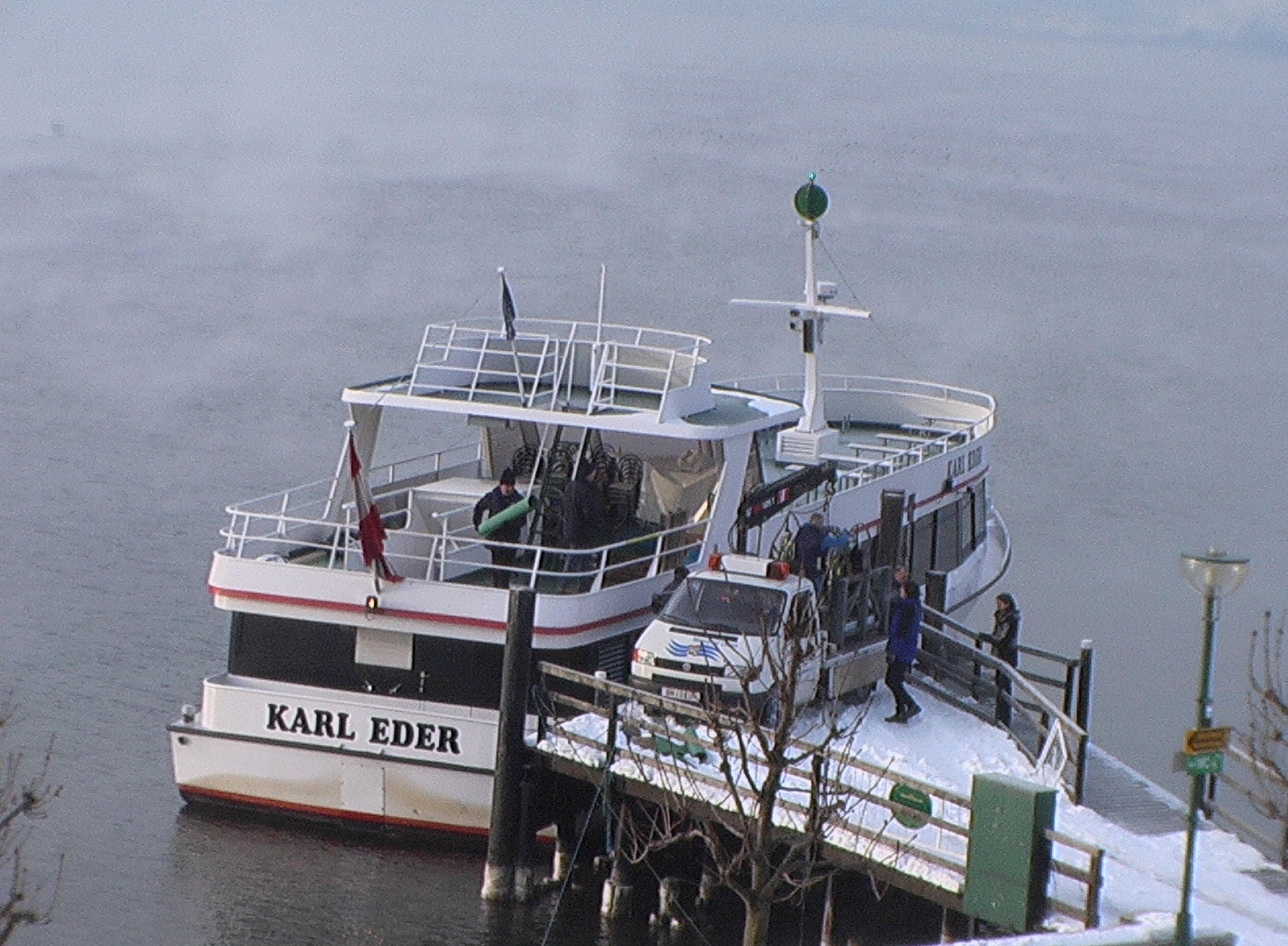 Loading of equipment on tourist vessel 'Karl Eder'
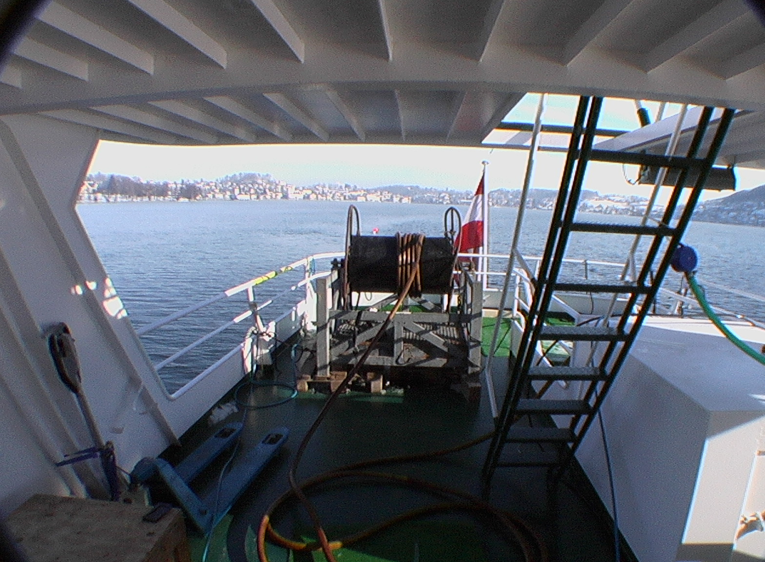
Streamwinch and streamer in operation