
Geoscientific Projects @MTU (38)
Here is an overview of geoscientific projects which had been supervised by MTU. They are part of the 3rd semester education and covers 15 CPs, which is worth half of a semester, complimentary to the research seminar. They can be carried out on almost any topic inside or close to geosciences, including stays at other research institutions, media projects, movies, data management etc. Just be creative and invent your own little research projects, lasting maximum 2 months.
2023
- x
2022
- Processing of airgun data from Arkona Basin, Baltic Sea
- Könnten geotechnische Verfahren durch marine Seismik ersetzt werden?
2021
- Evidence of a “homogenite” type deposit in the deep basin of Lake Issyk-Kul (Kyrgyzstan)
- Rio Grande Rise Deep Water Echo Facies and Mining Implications
- Seismic Processing and Interpretation of Data from Southern Argentine Margin
2020
- Mahndorfer Marsch – Früher, Heute, Zukunft
2019
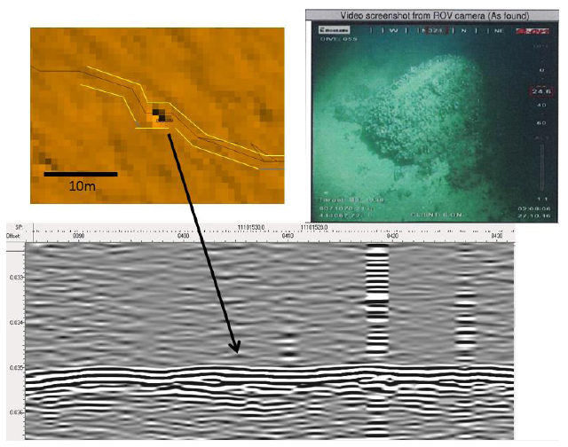
- Application of Diffraction Imaging on a dataset from the Batumi Seep Area, eastern Black Sea
- Detection of microplastics in water by using the high accuracy ISA500 sensor
- Archäologische Prospektion mit dem Georadar in Bremen Blumenthal
- Processing of multichannel seismic reflection data: Stratigraphical and structural description of sediments on southern Argentine Margin
2018
- Seismic Processing: Multichannel Seismic Data from Namibian Continental Slope
2017
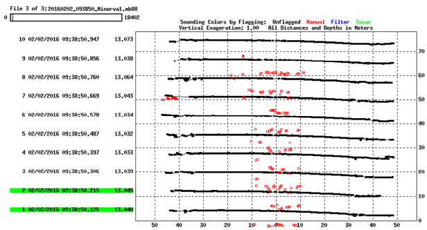
- Consistency analysis of seismo-acoustic data with regard to surface boulder detection at an Offshore Wind Park in the Baltic Sea
- Multichannel Seismic Processing and Interpretation: Cascadia Margin
- Multibeam sonar data processing – its application for bathymetry and fluid emission in the hydrothermally active offshore area of Campi Flegrei caldera
2016
- Multibeam und Sedimentecholot Datenanalyse Arkona Becken auf Datengrundlage der studentischen Ausfahrt AL446
- Prozessing von bathymetrischen Daten mittels MB-System: Nootka-Störungszone vor Vancouver Island (Kanada)
- Prozessing und Interpretation von Fächerlotdaten in der Campi Flegri caldera (Italien)
- Entwicklung und Bau eines Positionierungssystems für eine Seismikkanone mit Hilfe von Stereoskopie
- Multichannel Seismic Processing and Interpretation: Bengal Slope
2015
- Glacial Valley Investigation based on Seismic Profiles Windfarm Arkona Becken Südost – Baltic Sea
2014
- Seismic Reflection and Refraction Data Processing and Interpretation of Selected Profiles from the Baltic Sea - Aarhus Bay and Arkona Basin
- Tectonic and sedimentary structures of Issyk Kul, Kyrgyzstan - A view on seismic reflection data
2013
- Aquisition, Processing and Tomography Test on 2D Multichannel Seismic data, Aarhus Bay, Baltic Sea
- Development of a processing workflow for a very shallow multichannel riverine seismic dataset from the Jamuna River, Bangladesh
- Identification of gas related features as imaged by two different seismic acquisition systems at the accretionary margin of Makran
2012
- Using existing globally available CTD data for deriving sound velocity profiles
- 3D-Visualisierung der geologischen und tektonischen Bedingungen der Izmit Bay - Integration mariner akustischer Datensätze
- Hydroacoustic analysis of the water column and surface sediment structures off South-West Africa using an ATLAS Parasound echosounder
2011
- Marine Bioacoustics: Detection of marine mammals offshore Sylt employing a hydrophone chain typically used for high-resolution multichannel seismic
- Geologische Auswertung von Flachwasserseismik - Ein Beitrag zur Baugrunderkundung eines Offshore Windparks in der Nordsee
- Seismostratigraphic Analysis of the Zapiola Drift
2009
- Geophysical evidences of gas saturated sediments and gas seepage offshore Sassnitz
2008
- Detecting gas flares with Parasound, work documentation and ROV images of flare sites
- Seismic stratigraphy of the Northwest African continental margin controlled by long term glacial – interglacial climate development: Combined analysis of ODP sediment core data and high resolution seismic reflection data from offshore Cap Blanc
2007
- Untersuchung von Sedimentstrukturen des Makran – Akkretionskeils mit seismischen Methoden
- Frequency dependant amplitude analysis above blanking zones at Gudauta High, Black Sea
- Processing and analyzing two different seismic profiles from the Meteor M74/2 cruise of the Makran accretionary complex
- Backscatter Kartierung von EM120 Multibeam Daten am Chapopote, südlicher Golf von Mexiko
Examples
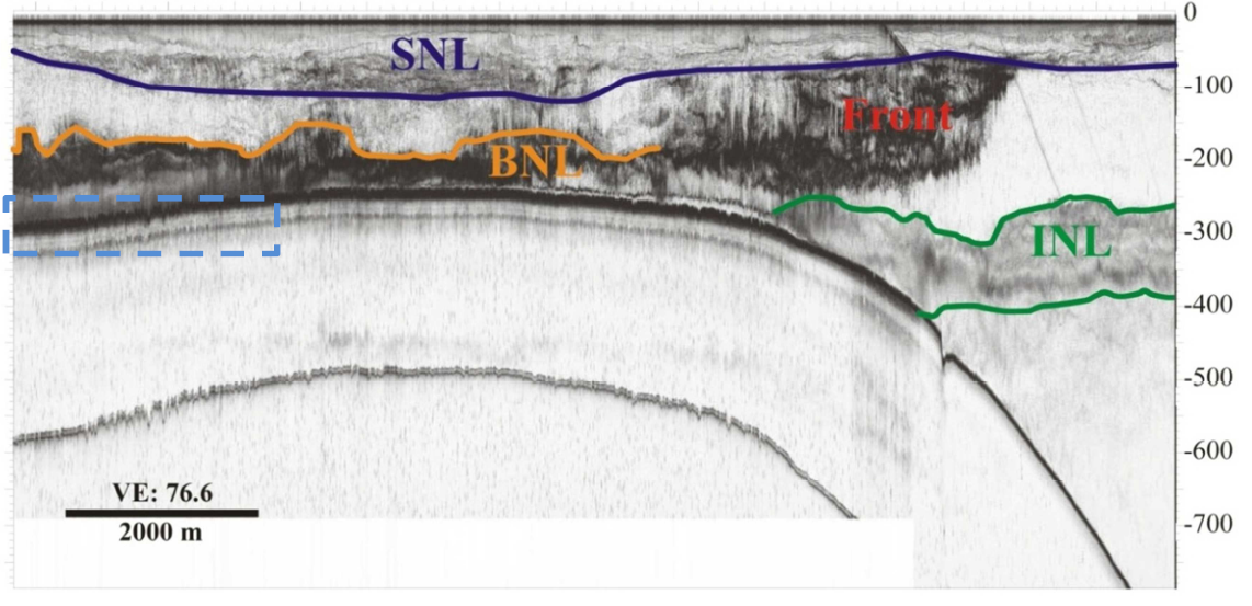
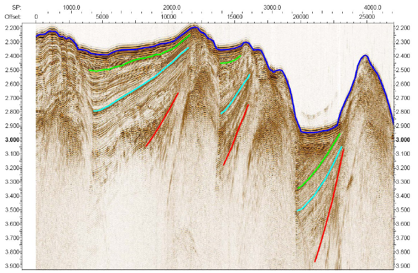 Accretion and Subsidence at the Makran Continental Margin
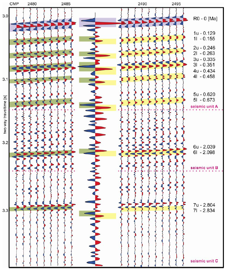
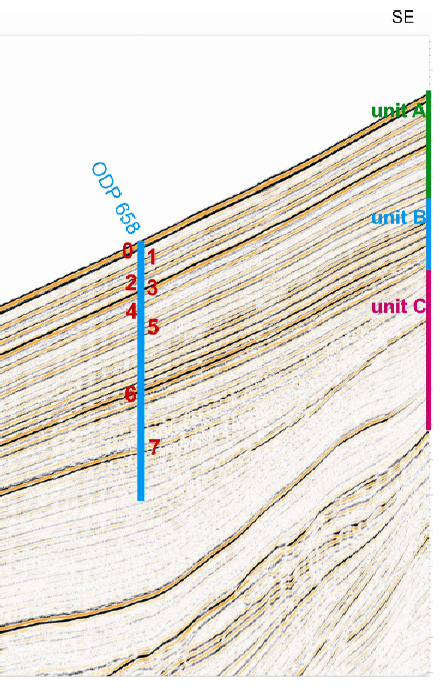
Seismic Stratigraphy at the Northwest African Margin
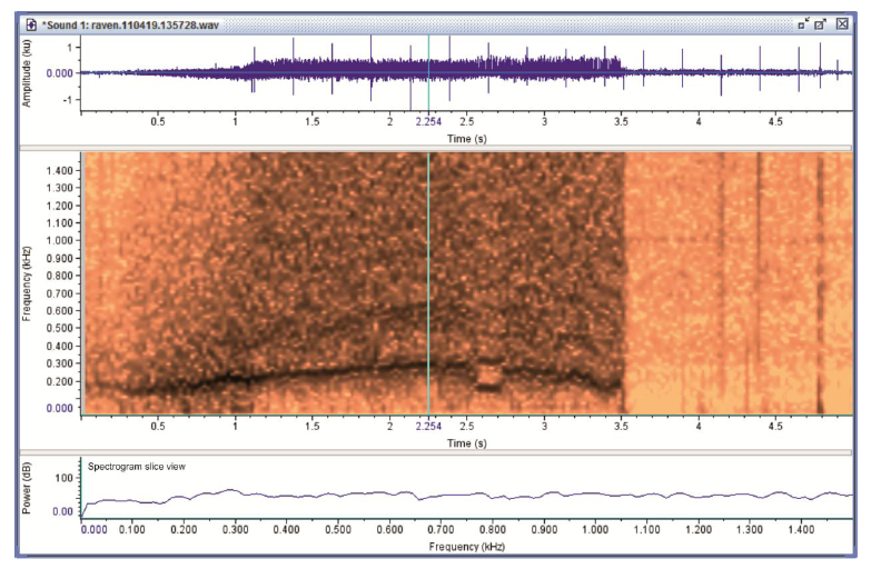
Bioacoustics of Seals near the Island of Sylt
Water Column Imaging at the SW African Margin
...
 Comparison of shallow gas occurrences in high and low-resolution seismic data offshore Makran
System Design for a Stereocamera to locate seismic source
...
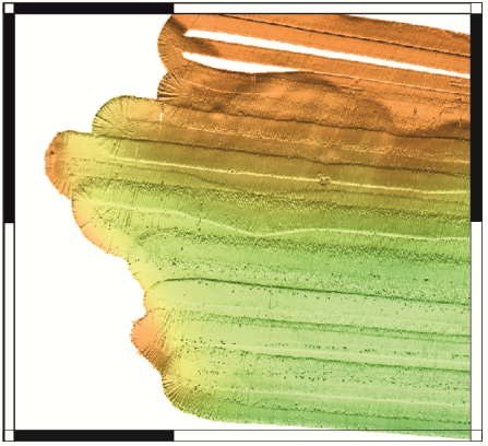
 Multibeam Processing Pozzuoli Bay
 Boulder Detection from Seismoacoustic Data
...
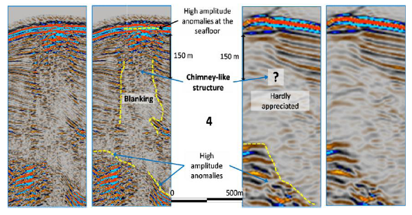
 Diffraction Imaging at a Seep Site
 Analysis of a homogenite unit in Lake Issyk-Kul