
2013 06 - R/V Heincke Cruise He405
Tracing the Holocene transgression of the North Sea in the German Bight
27.06 – 13.07.2013 : Bremerhaven – Bremerhaven
 Chief Scientist: Dr. Hanno Keil
MTU Participants: Özmaral, ..
Instrumentation
- Sparker
- Boomer
- Multibeam System Kongsberg EM710
- Innomar SES2000 Parametric Sediment Echosounder
- Vibrocorer
- CPTu
After the last major glaciation, the Weichsel glaciation, the modern North Sea shelf has been formed due to the global sea level rise of approximately 130 m. Reconstructions of shifts of the coastline in the German Bight due to the sea level rise are mainly based on the dating of coastal and near-surface peat deposits. The formation of these peat layers was stopped when the peats were flooded due to the marine transgression.
To extend the existing knowledge of the Holocene sea level change towards the early Holocene (>9 ka) and to increase the data quality, the expedition aims to investigate deeper buried peat layers in the interrelated dewatering system Elbe-Palaeovalley. These peat layers shall be systematically localized with seismic and geotechnical methods and, if possible, be sampled. By this new approach a continuous sequence of datable samples from exactly known subsurface depths shall be collected from the deeper to the shallower parts of the palaeovalley.
With the data to be obtained the early Holocene sea level rise shall be described in detail to achieve an understanding of the dynamics of a fast transgression. This can be of importance to develop adaptation strategies to a future fast rise of the sea level.
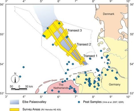
 Map of working areas and planned study sites. During the planned cruise several seismic profiles and core transects along and across the Elbe Palaeovalley (yellow) will be obtained. Blue dots show existing dated peat samples used to reconstruct the Early Holocene transgression into the German Bight. The number of data points in deeper marine sections (i.e. further offshore) reflecting the early transgression is still very limited. Based on the planned seismic surveys, those deeper peat layers will be mapped and sampled during the cruise
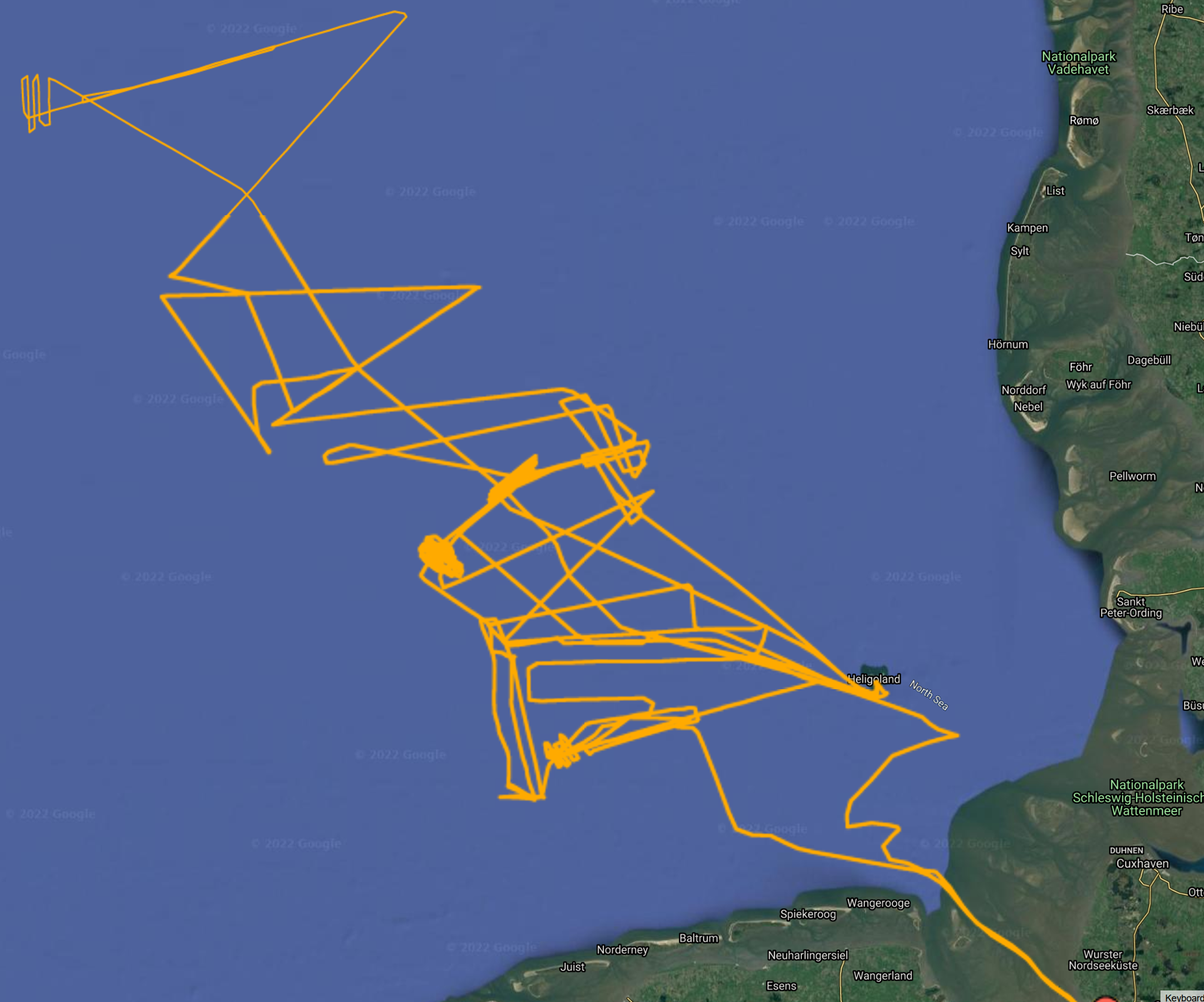
Track Chart of Cruise He405