
Wind Farm Surveys by MTU
North Sea
Overview of North Sea offshore windpark areas (OWP) (Wikipedia)
Southern German North Sea
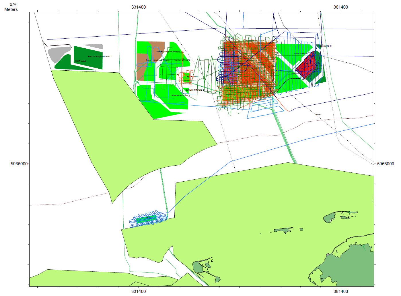
- Borkum Riffgatt
The windfarm area Borkum Riffgatt (Wikipedia) was surveyed among the first by MTU multichannel seismic in 2005 on Senckenberg Cruise SK05, resulting from a cooperation of BGR, MTU/RCOM and the company ENOVA. The park area is one of the few located with in 12 nm zone of Germany, close to the East Frisian Islands. The installation was finished in 2013. The MTU seismic data were used to integrate with soil probing and borehole data to receive permission for the foundation design.
- Alpha Ventus
The wind farm area Alpha Ventus (Wikipedia) was surveyed in 2008 on Senckenberg Cruise SK08, funded through MARUM subproject D4. It is located in 27 to 30 m water depth. Installation was finished in 2009 - it was the first German wind farm starting operation in the North Sea. The collected seismic data were complimentary and ued for research.
- ENOVA (now Delta1+2)
Windfarm area Delta1+2/ENOVA (Wikipedia) was surveyed in 2008 on Senckenberg Cruise SK08, funded through MARUM subproject D4. The collected seismic data were complimentary and ued for research.
- Innogy (now N3; Nordsee 1, 2, 3)
Windfarm area Innogy, now split into Nordsee 1 (Wikipedia) , 2 (Wikipedia) and 3 (Wikipedia) was surveyed in 2008 on Senckenberg Cruise SK08, funded through MARUM subproject D4. The collected seismic data were complimentary and ued for research.
- Godewind I, II, III
Windfarm area Godewind I (Wikipedia), II (Wikipedia) and III (Wikipedia) were surveyed in 2008 on Senckenberg Cruise SK08, funded through MARUM subproject D4. The collected seismic data were complimentary and ued for research.
Data were reprocessed for BSH in 2019.
Eastern German North Sea
Northern German North Sea

- Kaskasi-II
A 3D seismic data set was acquired by Fraunhofer IWES and MTU in 2017/2018 and further 2D seismic lines in 2021 on Heincke Cruise He569 for purposes of soil property quantification.
- Kaikas
As part of the BMWi project Seismik NordOst and through a cooperation with the windpark developer company WPD, we surveyed the windpark area KAIKAS during the Celtic Explorer Cruise CE11 in 2011, which was funded by BGR to collect data for the GPDN project (Geopotenziale Deutsche Nordsee). A main survey was carried out in 2016 during Cruise AT241.
OWP Kaikas later became integreted into windpark area N10-2
- Skua
 OWP Skua was surveyed as part of a commercial contract by Geo-Engineering to Fraunhofer IWES and MTU in 2014.
- N6 / N7
Few MCS seismic lines were acquired during WE173 Cruise in 2018.
N6-7 was surveyed during Cruises WE173 and AT009.
- N9
Windpark Area N9 was split into 4 parts, which had been visisted repeatedly by MTU in 2018, 2919 and 2021 during Cruises WE173, AT274, AT009.
- N10
Windpark Area N10 was split in 2 parts. They were surveyed during several cruise, starting with CE2011, followed by BSH funded cruises AT241 (2016), WE173 (2018), AT274 (2019) and AT009 (2021).
- N11 / N12 / N13
Only few seismic lines were so far acquired through windpark areas N11, N12 and N13. Relevant Cruises were FR07 (2007), CE11 (2011), WE173 (2018) and AT274 (2019)
Source: Maximilian Dörrbecker (Chumwa) - Eigenes Werk, using data and information from these web sites:Global Offshore Wind Farms Database, Bundesamt für Naturschutz, OpenSeaMap, TenneT, Bundesamt für Seeschifffahrt und Hydrographie, Noordzeeloket, European Offshore Renewable Energy Roadmap (ORECCA), OpenStreetMap, File:Windmill.svg, CC BY-SA 2.0, https://commons.wikimedia.org/w/index.php?curid=34011412

Baltic Sea
Overview of Baltic Sea wind farm areas (Wikipedia)
- Arkona Becken Südost (#9)
Alkor, Geofusion
- Arcadis Ost 1 (#7)
Fritz Reuter, Alkor
- Baltic Eagle (#8)
Alkor
- Baltic 2 (#3)
Alkor
- Windanker (now O-1-3) (#10)
Alkor

Irish Sea (Ireland)
During Celtic Voyager Cruise CV17013 in 2017, several wind farm areas had been surveyed with the MTU multichannel seismic system as part of the cooperation of MTU and Fraunhofer IWES with UCC and ICRAG. Among the designated areas, profiles were acquired across wind farm areas:
- Codling Bank
- Arklow Bank
- Kilmichael Assessment Area
- Helvic Head
- Celtic Sea
The expedition served the purpose of a better understanding of the subsurface structures and glacial history, and was not dedicated to specifically collect data for soil characterization. However, the data have improved the overall understanding of the shallow subsurface geology.